How Phone Location Tracking Works (GPS, Wi-Fi & Cell)
Your phone doesn’t magically know where it is. It makes a smart guess by listening to a few different signals at once, then picks the best estimate it can. An app reads that estimate, with your permission, and drops a dot on a map. That’s the whole trick. Once you understand the signals, everything else about location tracking makes sense: why the dot is sometimes spot-on and sometimes drifts a block, why it eats battery, and why those “type in a number to track anyone” websites are lying to you.
The big picture in plain English
Think of your phone as someone trying to figure out where they’re standing while blindfolded. They can’t see, but they can listen. They hear satellites overhead. They hear the names of nearby wi-fi networks. They feel which cell tower is closest. Each clue is a little vague on its own. Put them together and you get a pretty good fix.
Your phone does this dozens of times a minute. It runs the clues through a bit of math and produces two things: a set of coordinates, and a confidence radius. That radius is the “how sure am I” number. When your phone is confident, the radius is a few metres. When it’s guessing, the radius can be a whole city block. Maps apps often draw that uncertainty as a faint blue circle around the dot.
A location app never tracks a phone from the outside. It runs on the device, asks the operating system “where are we?”, and the OS hands back that estimate, but only if you granted permission. No permission, no location. That single fact clears up most of the myths you’ll read about.
The four ways a phone finds itself
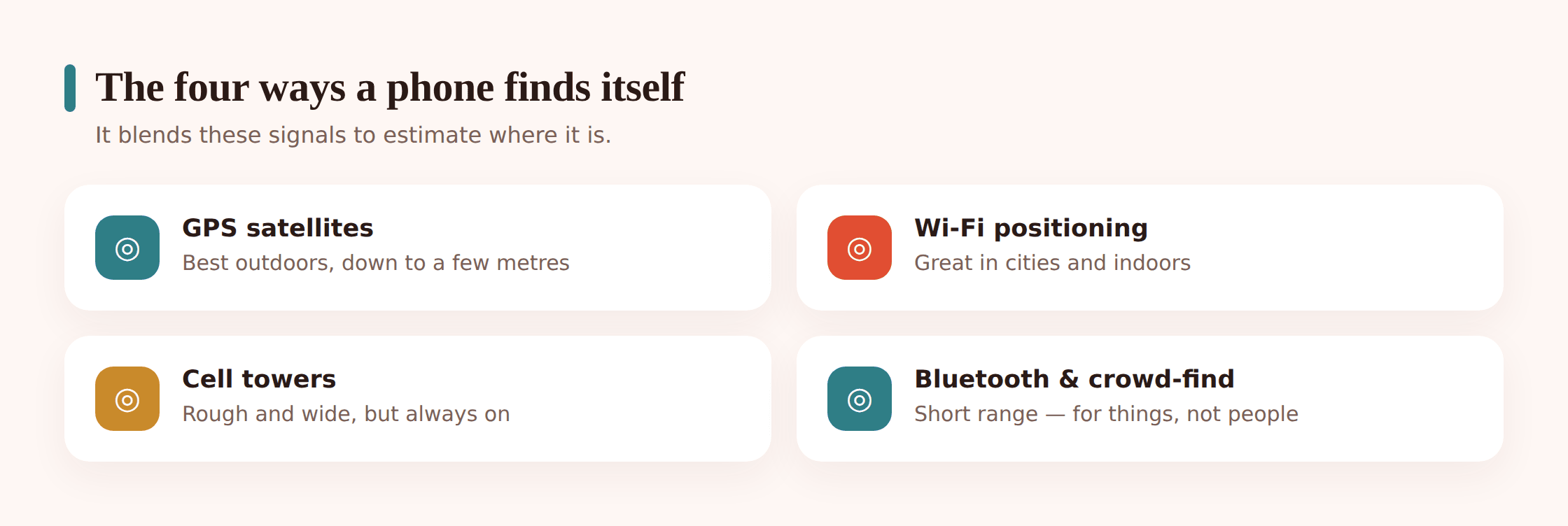
GPS and GNSS (the satellites). GPS is the American satellite system. GNSS is the umbrella term that also covers Galileo, GLONASS and BeiDou. Your phone listens to as many as it can. Each satellite broadcasts the time. By comparing tiny differences in when those time signals arrive, your phone works out its distance from each one, and where those distances cross is where you are. Outdoors with a clear view of the sky, this is the gold standard: a few metres, sometimes better. The catch is that satellite signals are faint. They struggle to punch through roofs, so GPS is weak indoors, and getting the first fix can take a few seconds while the phone finds enough satellites to lock on.
Wi-Fi positioning (the network names). Your phone doesn’t need to join a wi-fi network to use it for location. It just listens for the names and IDs that every router constantly broadcasts. Companies like Google and Apple have mapped where millions of those routers physically sit. So when your phone hears three known networks, it can match them against that database and place you, often within a handful of metres. This is why location works so well in a dense city or inside a mall, exactly where GPS falls apart. More routers around means a better fix.
Cell towers (the fallback). Your phone is always talking to nearby mobile towers. It knows roughly how far it is from each one. That gives a rough position, anywhere from a few hundred metres to a couple of kilometres wide, depending on how many towers are around. It’s coarse, but it has one great virtue: it works almost everywhere, even with wi-fi off and no satellites in sight. It’s the safety net.
Bluetooth beacons and tags (short range, for things). Bluetooth reaches only a short distance, so it isn’t used to place your phone across a city. Instead it’s used up close and for objects. A small tag on your keys or in your bag whispers over Bluetooth; nearby phones in a crowd-find network quietly pass along “I saw this tag here,” which is how you locate a lost item. Some indoor venues place beacons to guide you aisle by aisle. Handy for things, not how your phone tracks itself outdoors.
Assisted GPS ties it together. On its own, a satellite fix can be slow. Assisted GPS uses your mobile data connection to download a cheat sheet of where the satellites currently are, so the phone knows where to “look.” That’s why location snaps into place in a second or two on a modern phone instead of the long wait older GPS units had. In practice your phone runs all four methods together and merges them. When you turn on “high accuracy” mode, that’s exactly what you’re switching on: use everything.
Why accuracy varies so much
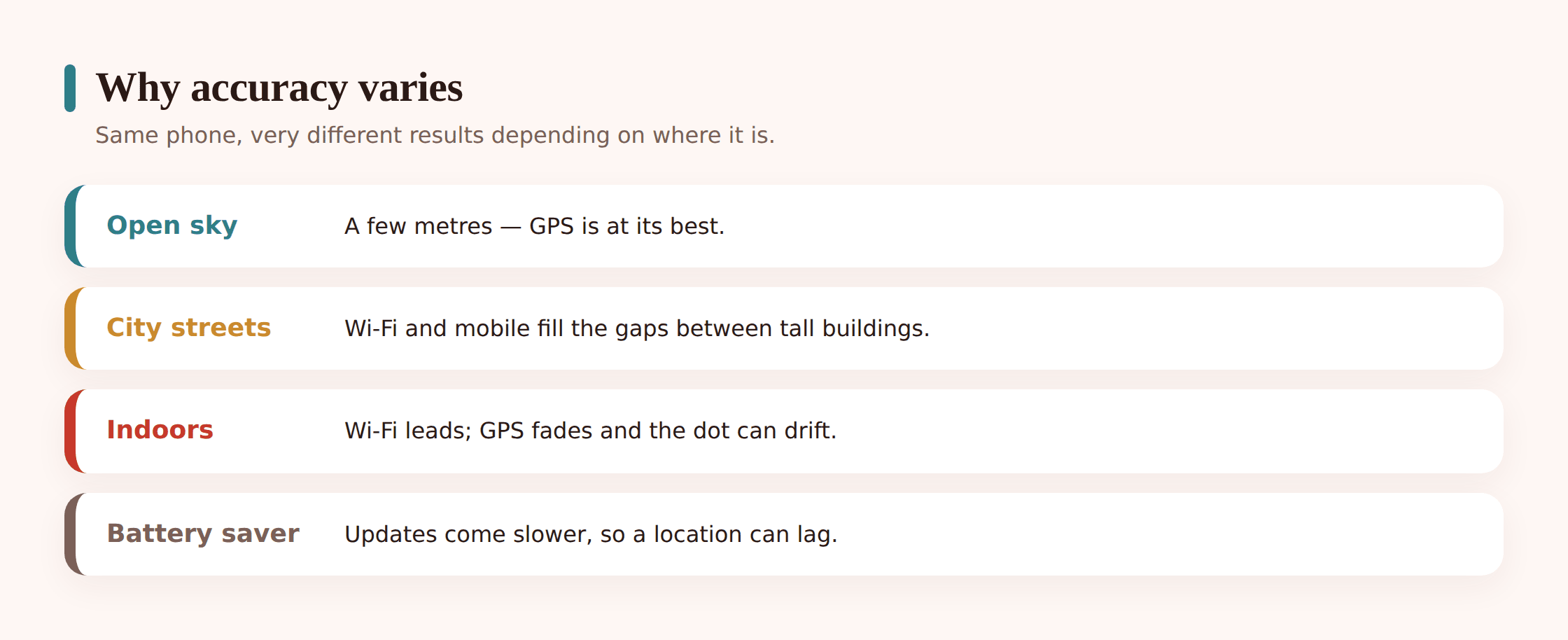
The single biggest factor is what’s above and around the phone. Open sky is a satellite’s best friend. Stand in a field and GPS is superb. Walk into a canyon of tall buildings and the signals bounce off glass and concrete before reaching you, so the phone can misread the timing and the dot drifts. Step indoors and satellites mostly give up, leaving wi-fi and cell to carry the fix.
Settings matter too. A “GPS only” or “device only” mode ignores wi-fi and mobile data, which saves battery but hurts accuracy indoors and in cities. High-accuracy mode uses everything and gives the best fix. Battery-saver modes often slow down or pause location updates, so the dot can lag behind where the person actually is.
That’s also why you sometimes see the dot jump, or see “last seen 10 minutes ago.” A jump usually means the phone got a fresh, more confident fix and corrected itself. “Last seen” means the phone couldn’t report right then: it was in a dead spot, off, in airplane mode, or the app was paused in the background to save power. None of that means anything is broken. It’s the honest edge of what the signals can do at that moment.
| Method | Typical accuracy | Works best | Battery cost |
|---|---|---|---|
| GPS / GNSS (satellites) | 3–10 m outdoors | Open sky, outdoors | High |
| Wi-Fi positioning | 5–20 m | Cities, indoors, malls | Low to medium |
| Cell towers | 150 m – 2 km | Anywhere with signal | Very low |
| Bluetooth beacons / tags | Under 10 m, short range | Nearby objects, indoor venues | Very low |
| High-accuracy (all combined) | A few metres | Most everyday places | Medium to high |
What location costs your battery
Satellites are the hungry part. Keeping the GPS chip actively hunting for a precise fix, over and over, draws real power. Wi-fi and cell positioning are much cheaper because the phone is already using those radios anyway. So the honest trade-off is accuracy versus battery: the more often you demand a fresh, precise fix, the more the battery drains.
Two settings control most of this. First, high-accuracy versus battery-saving: high accuracy fixes fast and precisely but costs more; battery-saving leans on wi-fi and cell and updates less often. Second, background permission. On Android you can grant location “while using the app” or “always.” A family-locator or find-my-phone tool needs “always,” because it has to report position when the app isn’t open on screen. A one-time map search only needs “while using.” Granting “always” to an app that doesn’t need it is the usual culprit behind a battery you can’t explain.
What apps can and can’t do
This is where the internet fills with nonsense, so let’s be blunt about both sides.
What a location app CAN do, when it’s installed on a device and given permission:
- Show live location on a map and update it as the person moves.
- Keep a history of where the device has been.
- Save named Places like home, school or work.
- Send an alert when the device arrives at or leaves a Place. That’s geofencing.
- Help you find a phone that’s lost or stolen, as long as it’s on and connected.
What no app can do, no matter what an ad promises:
- Secretly pinpoint any phone from just a phone number. The “enter a number and track anyone” websites are scams. They either harvest your money, your details, or both, and then show you a fake map. A phone number alone doesn’t expose someone’s live GPS. Only the phone carrier and, with a warrant, law enforcement can approximate a location from network data, and that’s coarse.
- Track a device it has never had access to. If nothing is installed and no permission was granted, there’s no location to read. Software can’t reach across the internet and switch on a stranger’s GPS.
- Beat airplane mode, a powered-off phone, or a dead battery. No signal out means no position in.
Permissions and protecting your privacy
Your phone gives you real control. It’s worth knowing where the switches are, both for your own privacy and to understand what a monitoring app can and can’t reach.
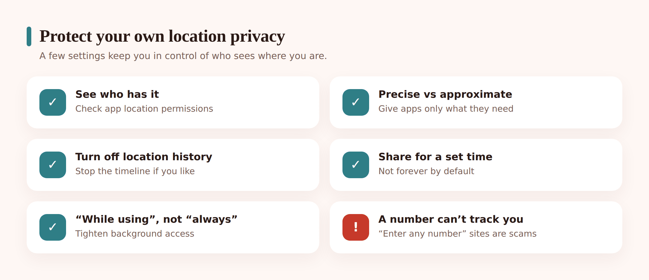
- See who has your location. In Android settings, open the location section and look at recent access and app permissions. You’ll see every app that’s asked, and which ones have “always” access.
- Precise vs approximate. Modern Android lets you give an app your exact spot or just a rough area. For weather or local news, approximate is plenty. For navigation or a family locator, precise is the point.
- While using vs always. Only give background (“always”) access to apps that genuinely need to report when closed.
- Turn off location history. In your Google account you can pause or delete Timeline history whenever you like. That’s separate from any individual app.
- Share for a set time. Google Maps and Apple’s tools let you share your live location for an hour, or until you turn it off. Great for meeting a friend or a night out, with a clear end.
If you use an iPhone rather than Android, your best built-in options are Apple’s Find My and location sharing in Google Maps. FreePhoneSpy’s app is built for Android; for an iPhone in the family, set up sharing through those Apple and Google tools instead.
Consent, and where the line is
Location tech is neutral. How you use it is not. There’s a bright line between sharing and spying, and it comes down to whether the other person knows and agrees.
For kids, transparency isn’t just the legal path, it’s the parenting path. A child who knows the locator is there learns that it’s about safety, not suspicion. Talk about it, show them the map, let them see it works both ways where it can. Our family location sharing guide walks through how to set that up as a shared, open thing rather than something done to them.
How FreePhoneSpy uses all this
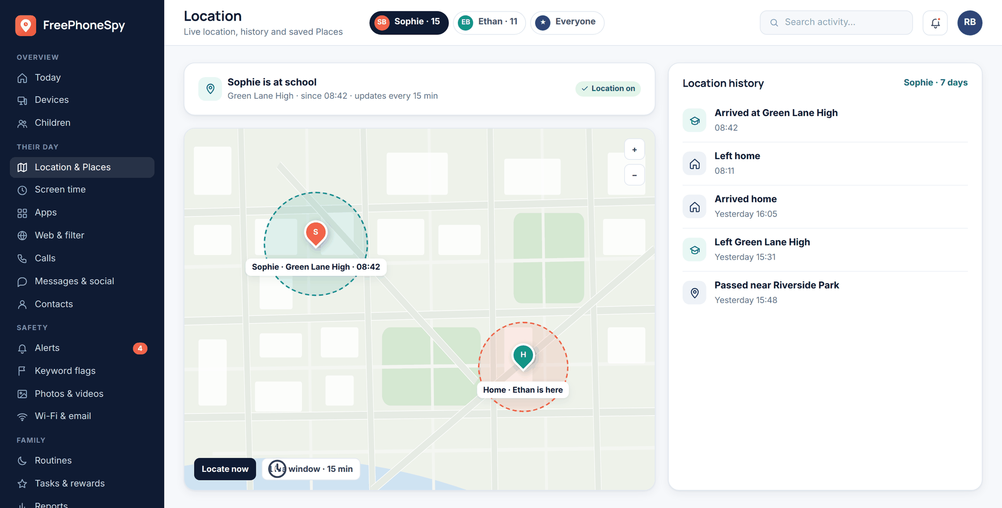
FreePhoneSpy is a parental and family monitoring tool for Android phones, and you view everything from any web browser through the web panel. It reads the same location estimate we’ve been describing, blended from GPS, wi-fi and cell, and shows it on a map. Nothing exotic. It’s honest software using the phone’s own positioning, with permission, and it stays visible on the device.
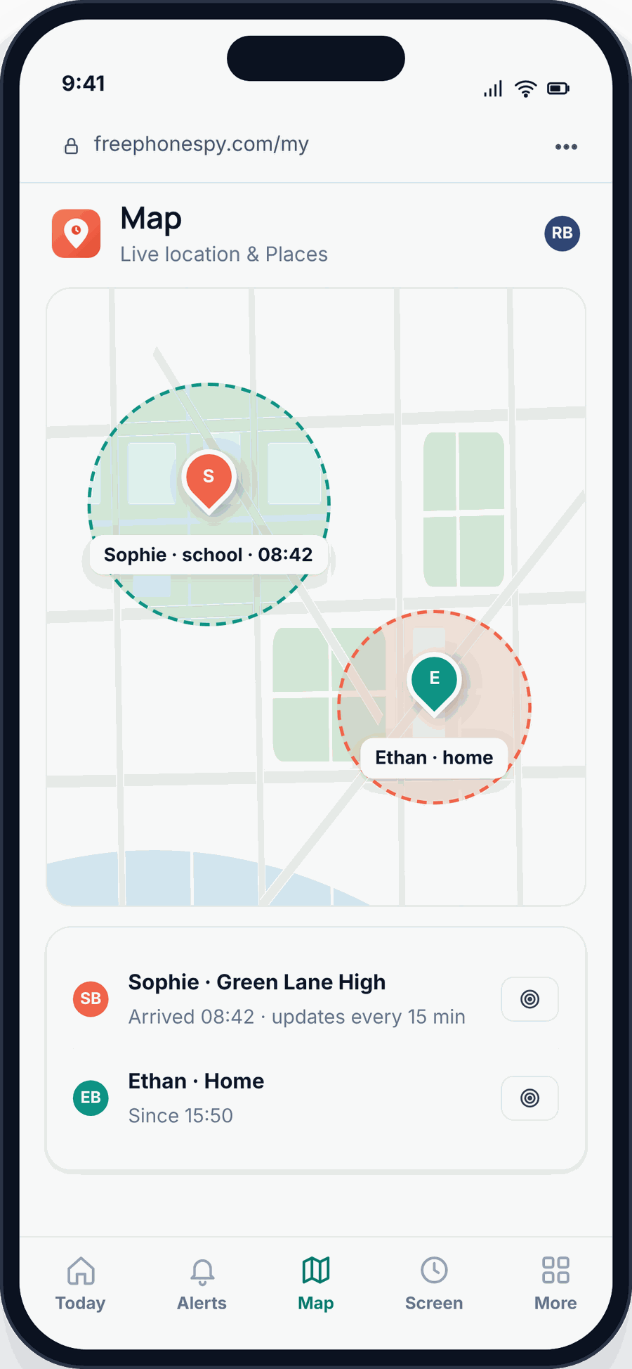
From the panel you get live location, a locate-now button when you want a fresh fix, and a live-location window for following along in real time. Location history lets you look back over the day. It’s the practical version of everything above: a fast fix in the open, a slightly wider circle indoors, and “last seen” when the phone briefly drops off. You can dig into all of it on the location and Places page.
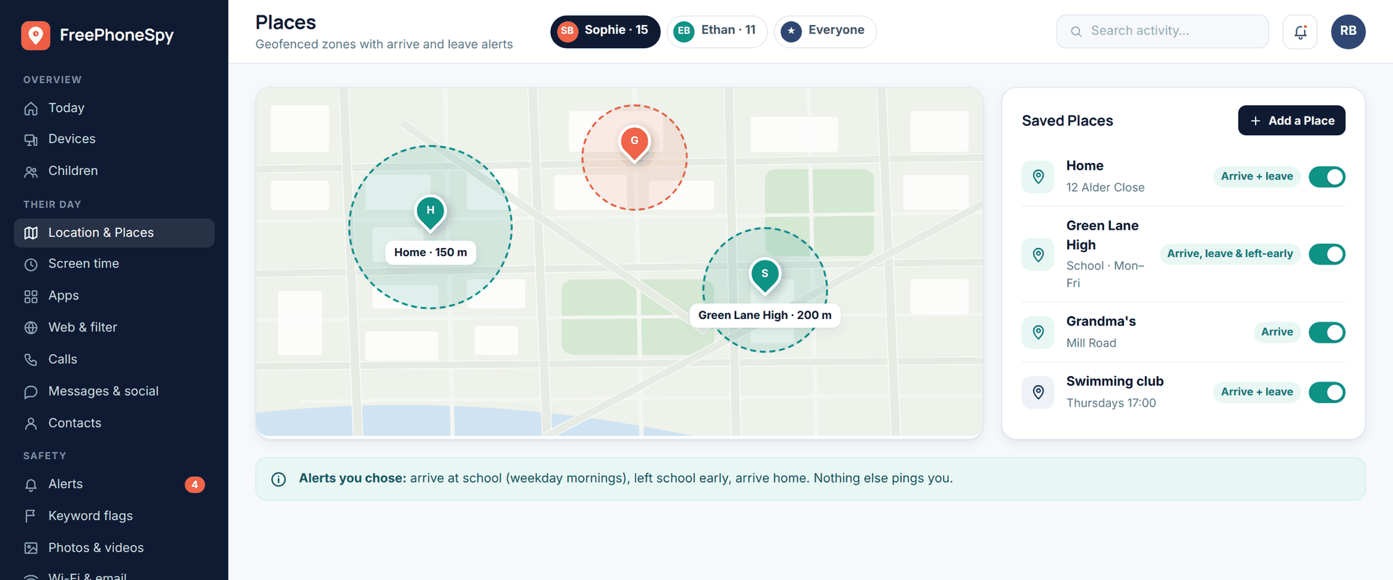
Places is where it gets genuinely useful. Save home, school, a grandparent’s house, and turn on arrive and leave alerts. You get a quiet notification when your child reaches school and when they leave, without staring at a map. That’s geofencing, and you can tune it on the location alerts page. If a phone ever goes missing, the same live location helps you find a lost or stolen phone while it’s still on and connected.
It’s free to start, and kept free by completing simple tasks; location and the core features stay free. If a younger child in the family is too small for a phone, a dedicated kids GPS watch can be a gentler first step, and the same location ideas apply.
FAQ
Can I really track any phone just by typing in its number?
No. That’s a scam. A phone number by itself doesn’t expose someone’s live GPS. Any site promising it is after your money or your data. Real tracking needs an app on the device and permission.
Why does the location dot sometimes jump or drift?
The phone got a newer, more confident fix and corrected itself, or it was in a spot where signals bounce, like between tall buildings. It’s normal. The blue circle around the dot shows how sure the phone is.
Does location tracking drain the battery?
It can, mostly from the GPS chip and from apps holding “always” access. High-accuracy mode and frequent updates cost more; wi-fi and cell positioning cost little. Give background location only to apps that truly need it.
Why does it say “last seen” instead of showing live location?
The phone couldn’t report right then. It was off, in airplane mode, out of signal, or the app was paused in the background. Once it reconnects, the live location comes back.
Does it work on iPhone?
The FreePhoneSpy app is for Android. For an iPhone, use Apple’s Find My or share location through Google Maps. The location principles in this article apply either way.
Will my child know the app is there?
Yes, and that’s by design. FreePhoneSpy stays visible on the device. It’s meant for consent-first family use, not covert tracking.